Practical : EO Browser tool for land Applications
Completion requirements
EO Browser a web tool for Land Applications
EO Browser is a free spatial data visualization tool that allows users to search and study a vast amount of satellite imagery: Sentinel-2 and Sentinel-3, Landsat 5, 7 and 8. All of these can be found in the same place. In EO Browser no registration is needed to access standard functions.
Let’s see how can see flooding with this web tool:
1. Go to: https://apps.sentinel-hub.com/eo-browser/

Step 1 – Search for the area of your interest, by navigating the map.
- In this case, navigate to the area in the red square (North of Oman)

Step 2 – Set up your configuration:
- Choosing satellites: Sentinel2
- Time Range: 2021-10-05
- Then Search.

Step 3 –Visualize the image
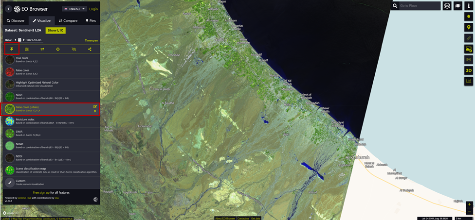
- In the Results tab, you can navigate through your search results and select the suitable data for you. Click Visualize.
- The Visualisation tab will allow you to view your selected data.
- In this case: You will get only two results, please visualise the first one.

- Choose false colour (urban) and click on
 icon
to pin the image.

- Repeat Step3 for day 05/09/2021, don't forget to pin the image

Step 4 – Compare the two images :
- Go to Compare
- And then slid the split position to shift between the two images.
- You can now, the area before and after Shaheen Tropical cyclone Flooding.

You can now try to visualise any case from your Area, please share your results in the Forum.
Well Done.
